 Scan Tech Surveys
The Modern Approach to Surveying
Scan Tech Surveys
The Modern Approach to Surveying
3D Scanning Surveys
Understanding your needs in your project is the most important part of our job. We first aquire a thorough knowledge of what you need and based on this mutual understanding we provide the best solution.
Using variety range of 3D Laser Scanning technologies gives us the capability to come up with the best solutions;
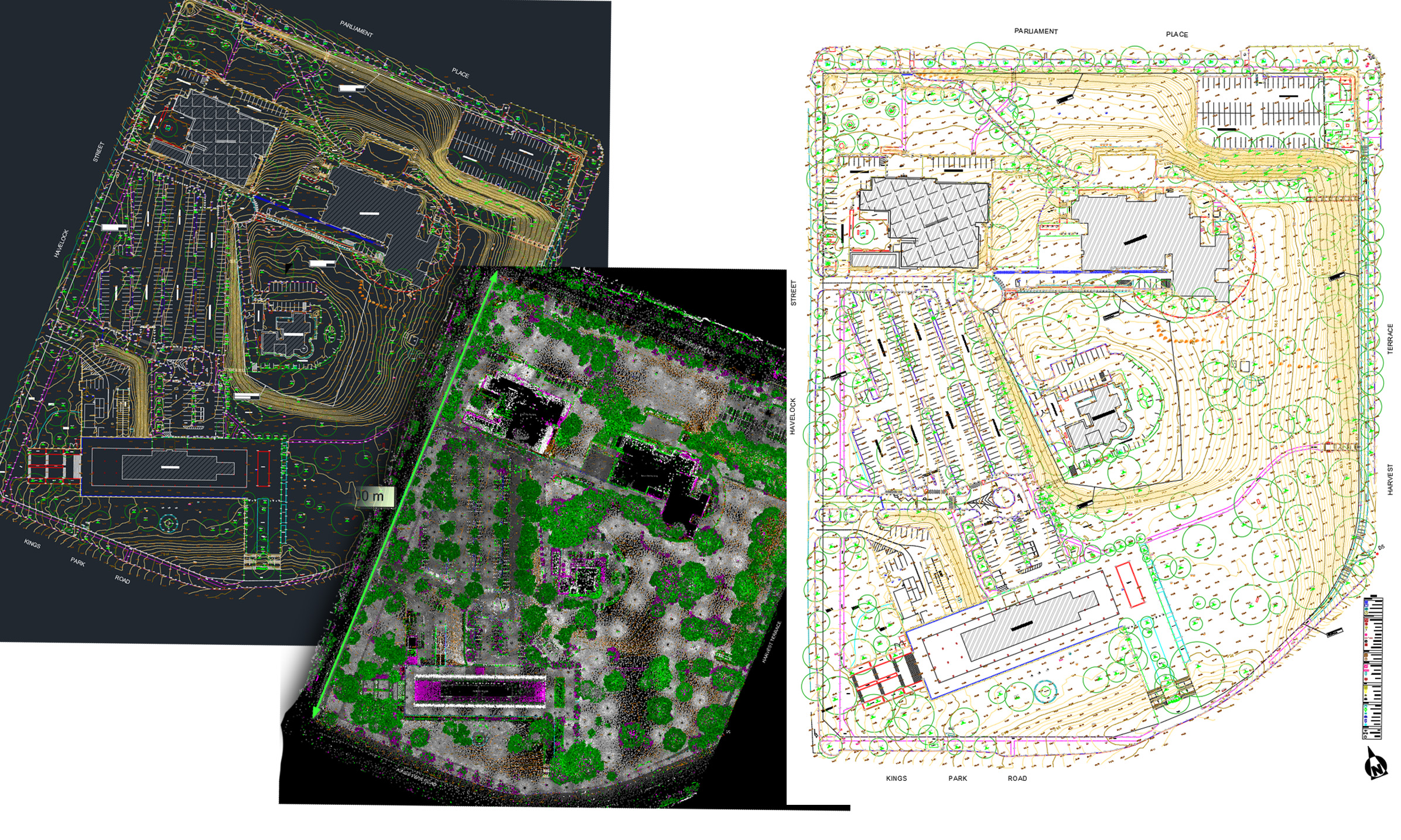
Contour & Feature Surveys
Using 3D Laser Scanning technology, leave no element of doubt for feature surveys, so we don’t miss anything in the field and create a digital twin of the site.
We capture Once and use Many; every details are captured via 3D scanning so feature surveys could not be more complete.
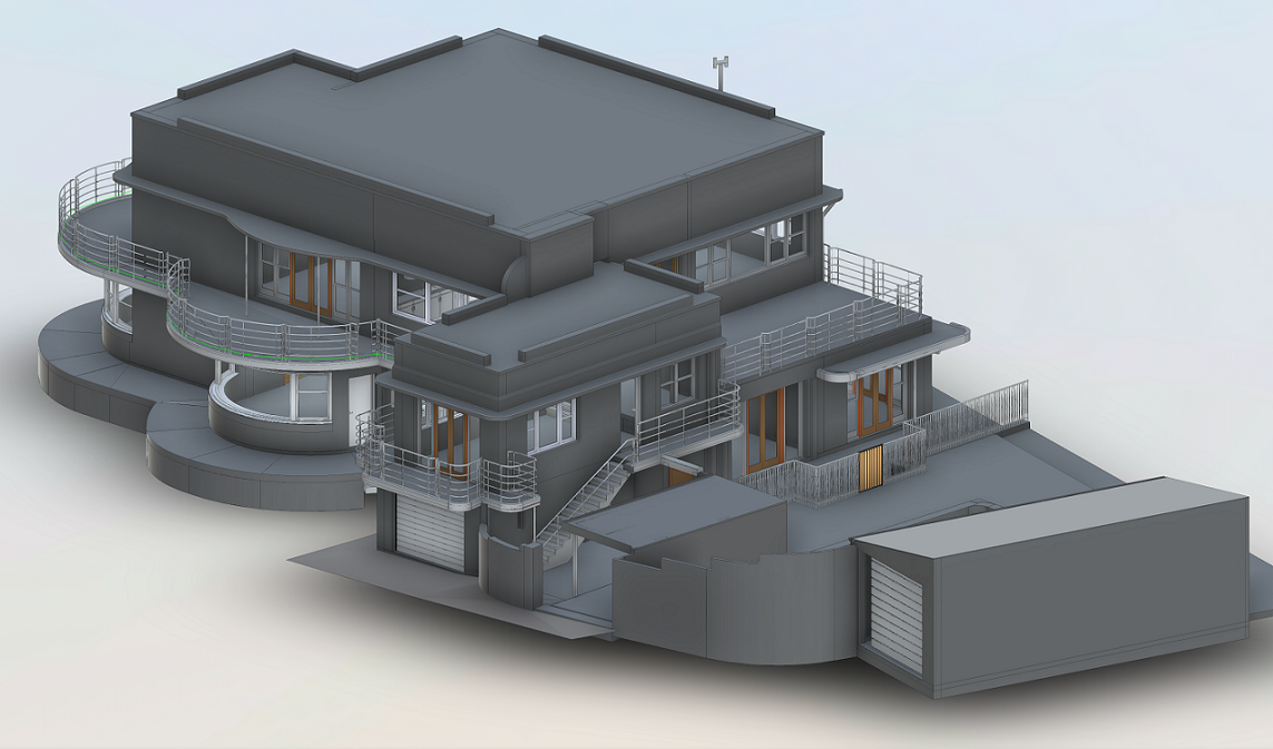
BIM (Building Information Modelling)
We cover a variety of BIM and 3D modeling in Revit format. Our BIM services can deliver LOD 200, LOD 300, LOD 400 and LOD 500 models suitable for renovation, retrofit designs and rezoning applications.
3D Laser Scanning is the most suitable methodology to create BIM models.
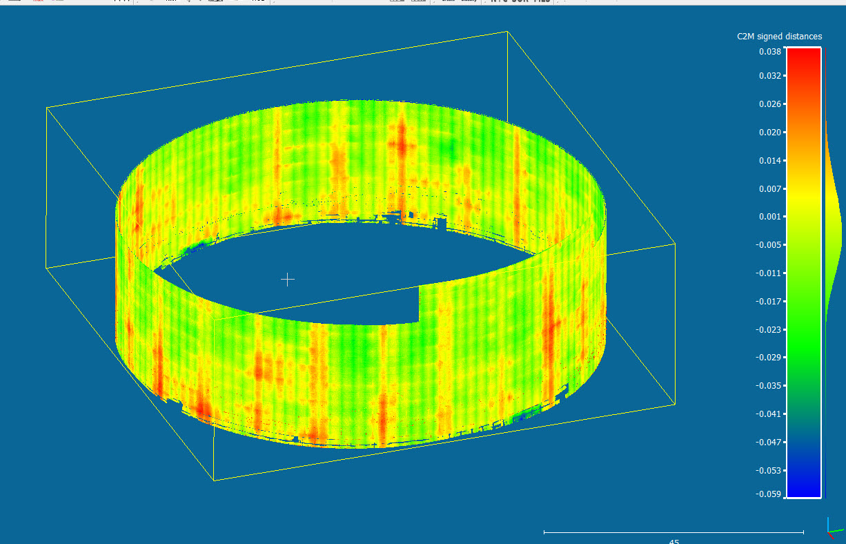
Deflection & Deformation Surveys
Your project has been built according to design but needs to be checked?! Get in touch with us we have full range of as-built reports including comparison to design for understanding deflection and deformations. Bridges, Tanks, Vessels, Concert Beams, Slabs and etc, they all need to be checked. We also provide slab flatness and levelness reports which helps to understand the pits and bumps aeras on the surface of the slab.
As-built reports are important to be conducted but more important than that is comparing design to as-built in order to understand the possible deformations and deflections.
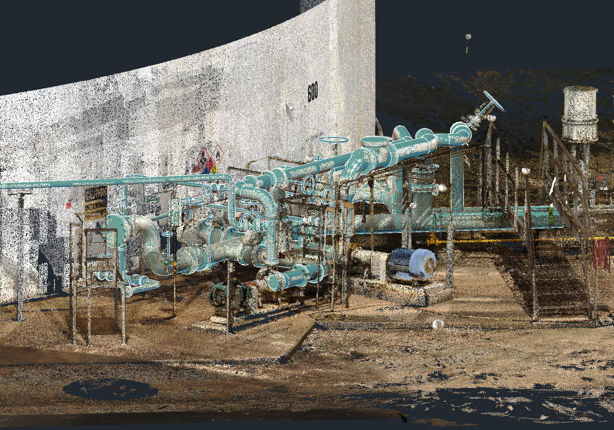
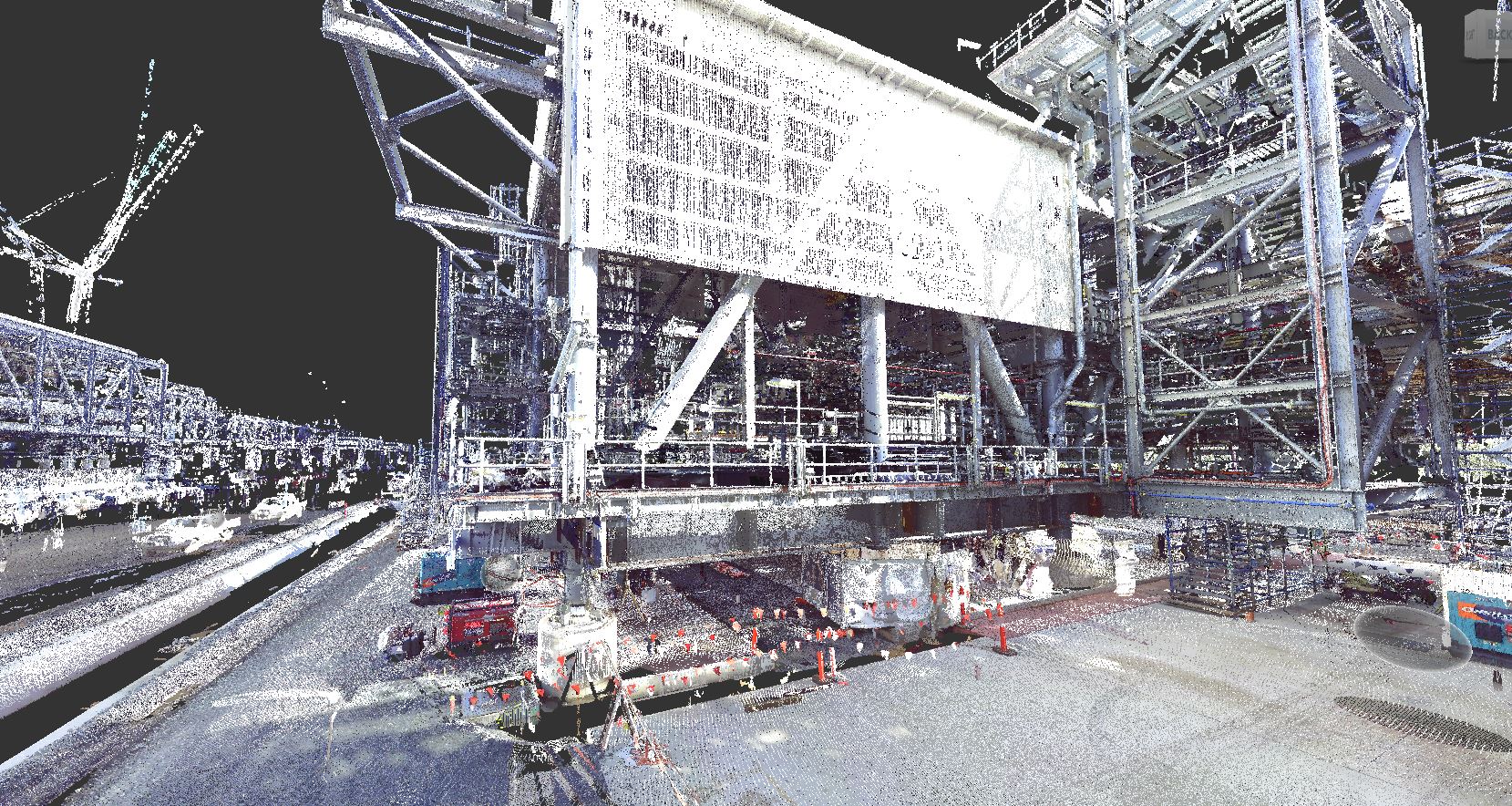
Plant 3D Scanning and Modelling
We utilize Leica P50 Scan Station with accuracy of 3mm and noise level of 1mm to capture accurate and complete point cloud of plants and piping components. Models can be delivered in variety of formats such as RVT (Revit), DWG (AutoCAD), PDMS. The data can be used for clash detection in retrofitting projects.
3D scanning saves lots of time and increases efficiency in plant and piping design. It brings the digital twin of the plant to designers office.
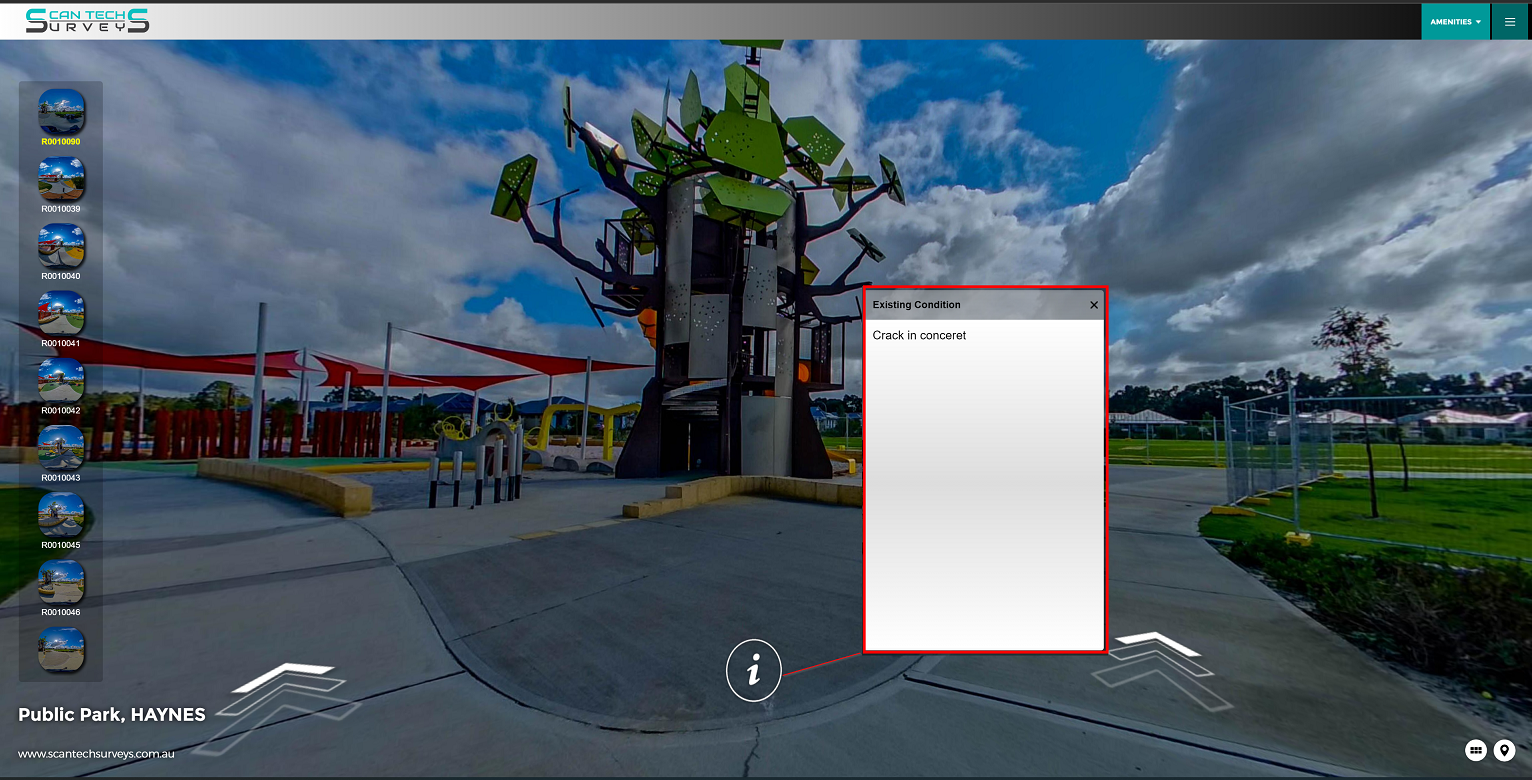
Dilapidation Surveys
As technology is the key to increase efficiency, for dilapidation surveys we don't use the conventional methods. All of our dilapidation surveys are done via conducting a virtual tour utilising spherical 360 camera (Ricoh Z1) . We take close shot images with mobile phone and insert all necessary commentary such as existing defects from pre-work construction stage. So you have a live record of the site before starting the job. This helps you to be in a string position regards with property damage during construction work and insurance purposes.
Here is a sample link:
https://scantechsurveys.com.au/Virtualtours/hayens/index.htm
By using virtual tours for dilapidation surveys, %100 of the existing condition of the site will be captured and documented before construction begins.
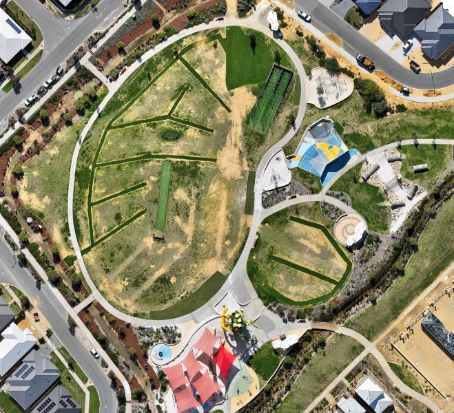
Drone Mapping | Aerial Surveys
Drone mapping, also known as aerial mapping or remote sensing, involves the use of drones (unmanned aerial vehicles or UAVs) equipped with various sensors to capture data and imagery for creating accurate and detailed maps of a specific area or location. This technology has gained significant popularity due to its efficiency, cost-effectiveness, and versatility in various fields, including agriculture, land surveying, environmental monitoring, construction, archaeology, and more.
Here is a sample link:
https://scantechsurveys.com.au/Potree_1.8/Gallery/DroneSample/TreeParkDrone.html
Unlocking a new perspective from above, drone mapping empowers industries with accurate data and rich visuals. From farms to construction sites, its wings of innovation capture insights that transform possibilities into realities.
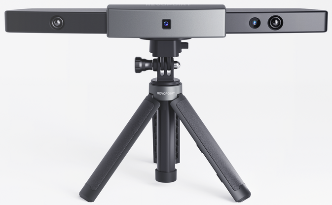
3D Scanning Objects
We are pleased to offer our high-precision 3D scanning services with sub-millimeter accuracy using state-of-the-art structured light scanning technology.At SCAN TECH SURVEYS, we redefine precision. Our mission is simple yet transformative: to provide you with sub-millimeter accuracy 3D scanning solutions that set new standards for excellence. With cutting-edge technology and unwavering commitment to quality, we turn your visions into highly detailed, digital realities.
Unlock the Power of Sub-Millimeter Precision with Structured Light Scanning
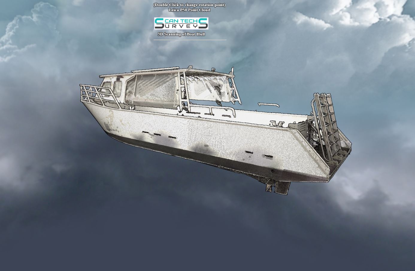
Boat 3D Scanning
We utilise state-of-the-art laser scanning technology to transform the process of inspecting and evaluating boats. Our advanced scanners employ laser beams to meticulously capture every aspect of your boat's intricate geometry and dimensions, ensuring thorough coverage without overlooking any detail.
Welcome to the forefront of marine technology with 3D Laser Scanning for Boats. Dive into a world where precision meets efficiency, where every detail of your vessel is captured with unparalleled accuracy and clarity.