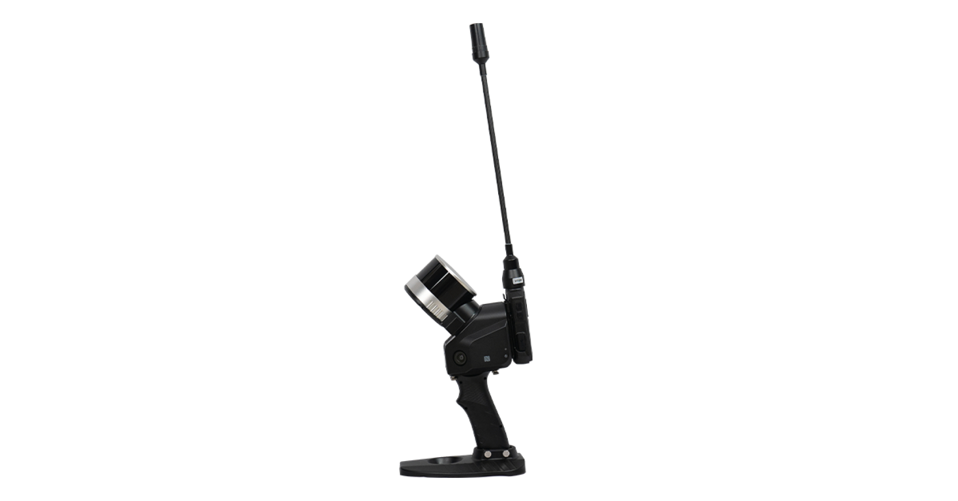
Slam Mobile Scanner
A SLAM (Simultaneous Localization and Mapping) handheld scanner with RTK (Real-Time Kinematic) positioning combines the capabilities of SLAM technology with highly accurate real-time positioning. This combination offers several benefits in various applications:
High Precision Mapping: RTK positioning provides centimeter-level accuracy in real-time. When combined with SLAM, it enables the creation of extremely precise 3D maps of environments. This is especially useful in applications like construction, archaeology, and forestry, where accurate mapping is critical.
- Efficient Surveying: Surveyors and land professionals can use SLAM handheld scanners with RTK to significantly reduce surveying time and effort. The high accuracy of RTK ensures that survey data is reliable, while SLAM technology helps automate the mapping process, making it more efficient.
- Indoor and GPS-Denied Environments: Traditional GPS systems may not work well indoors or in environments with limited GPS signal availability (e.g., dense urban areas or forests). SLAM with RTK allows for precise mapping and positioning in such GPS-denied scenarios, making it valuable for indoor navigation, construction within buildings, or forest management.
- Improved Augmented Reality: When used in augmented reality (AR) applications, the combination of SLAM and RTK allows for more accurate and stable AR overlays. This can enhance user experiences in gaming, navigation, or industrial training scenarios.
- Autonomous Robotics: SLAM with RTK is crucial for autonomous robots, drones, and vehicles operating in dynamic, unstructured environments. The high precision of RTK positioning combined with SLAM's mapping capabilities enables safe and efficient navigation, making these technologies suitable for agriculture, search and rescue, and autonomous vehicles.
- Reduced Drift and Error: RTK helps mitigate drift and cumulative error in the SLAM system. Over time, SLAM systems can accumulate errors in position estimation, especially in large environments. RTK positioning provides corrections that keep the SLAM map aligned with the real-world environment.
- Emergency Response and Disaster Management: SLAM handheld scanners with RTK positioning can be invaluable in emergency response and disaster management. They can quickly create accurate maps of disaster-stricken areas, aiding rescue teams in their efforts to locate victims and plan rescue operations.
- Infrastructure Inspection: Infrastructure inspection, such as power lines, pipelines, and bridges, can benefit from the high accuracy of RTK positioning when combined with SLAM. It allows for precise monitoring, maintenance planning, and anomaly detection.
- Reduced Manual Intervention: With RTK-enhanced SLAM, there is less reliance on manual measurements and positioning, reducing the risk of human error and speeding up data collection and analysis processes.
- Cost Savings: While RTK-equipped devices and SLAM technology can be an investment, the increased efficiency, accuracy, and reduced need for manual labor can lead to significant cost savings in various industries over the long term.
Overall, the combination of SLAM handheld scanners with RTK positioning offers enhanced accuracy and efficiency across a wide range of applications, making it a valuable tool for professionals in fields such as surveying, construction, robotics, and emergency response.
"Unlock a new dimension of accuracy and productivity with the Slam RTK handheld scanner, revolutionizing spatial data capture.
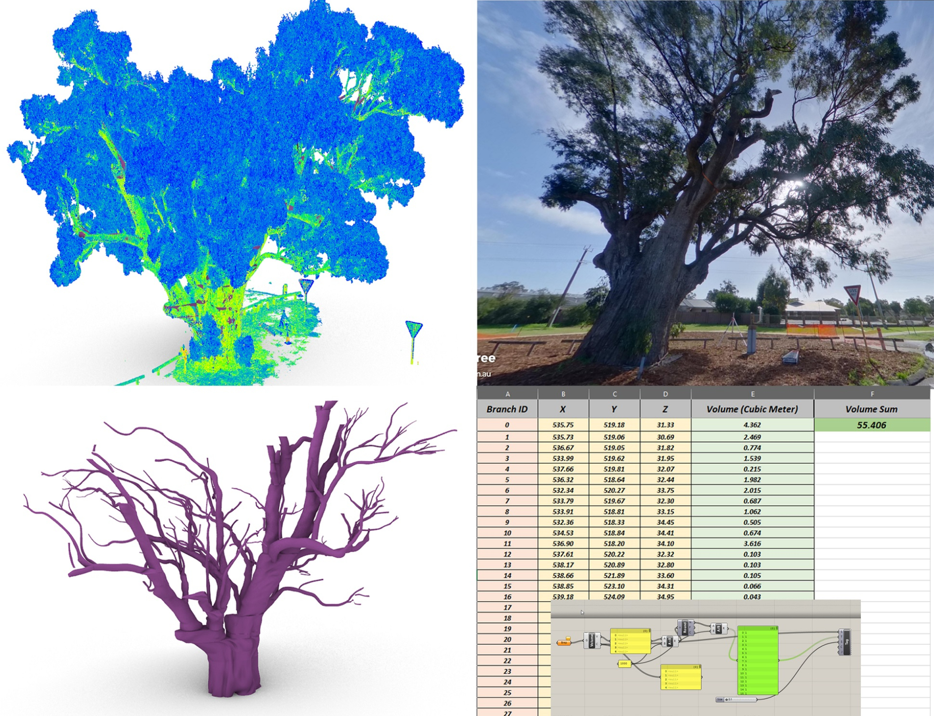
3D Scanning of Tree and Calculating Volume of Branches
Using 3D scanning technology to calculate the volume of tree branches can offer several benefits in various applications, including forestry management, environmental research, and urban planning. Here are some advantages of using 3D scanning for this purpose:
-
Accurate Volume Calculation: 3D scanning provides a highly accurate way to measure the volume of tree branches. This precision is important for making informed decisions about tree health, biomass estimation, and resource allocation.
-
Non-Intrusive Method: Traditional methods of measuring tree volume, such as felling the tree and sectioning its branches, can be destructive and harmful to the environment. 3D scanning allows for non-intrusive measurements, which preserves the tree and its ecosystem.
-
Efficiency: 3D scanning technology is relatively quick and efficient. It can capture a detailed 3D model of the tree's branches in a short amount of time, saving labor and resources compared to manual measurements.
-
Data Visualization: The 3D models generated from scanning can provide visual representations of the tree's structure, allowing researchers and decision-makers to better understand the branching patterns and overall health of the tree.
-
Biomass Estimation: Accurate volume calculations from 3D scanning can help estimate the biomass of the tree's branches. This information is valuable for assessing carbon sequestration potential, fuelwood availability, and other ecological considerations.
- Preservation from falling: In case the tree is old (like this example), 3D scanning helps structural engineering to come up with accurate design regards with designing proper rated scaffolding or steel structure to preserve the tree to crack down and falling apart.
3D laser scanning is the most efficient mthod to calcualte the volume of a tree via 3D modeling process.