
Project Overview
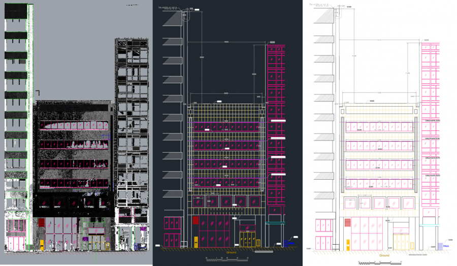
The main goal of this project was generating the 2D Elevation View of a 6-story façade. The challenge of the project was a big tree in front of the building so multiple setups had to be done to get the full details.
The elevation view was delivered in AHD (Australian Height Datum).
- Location: Perth City
- Category: 3D Scanning - Architectural
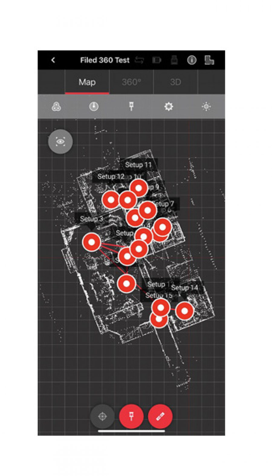
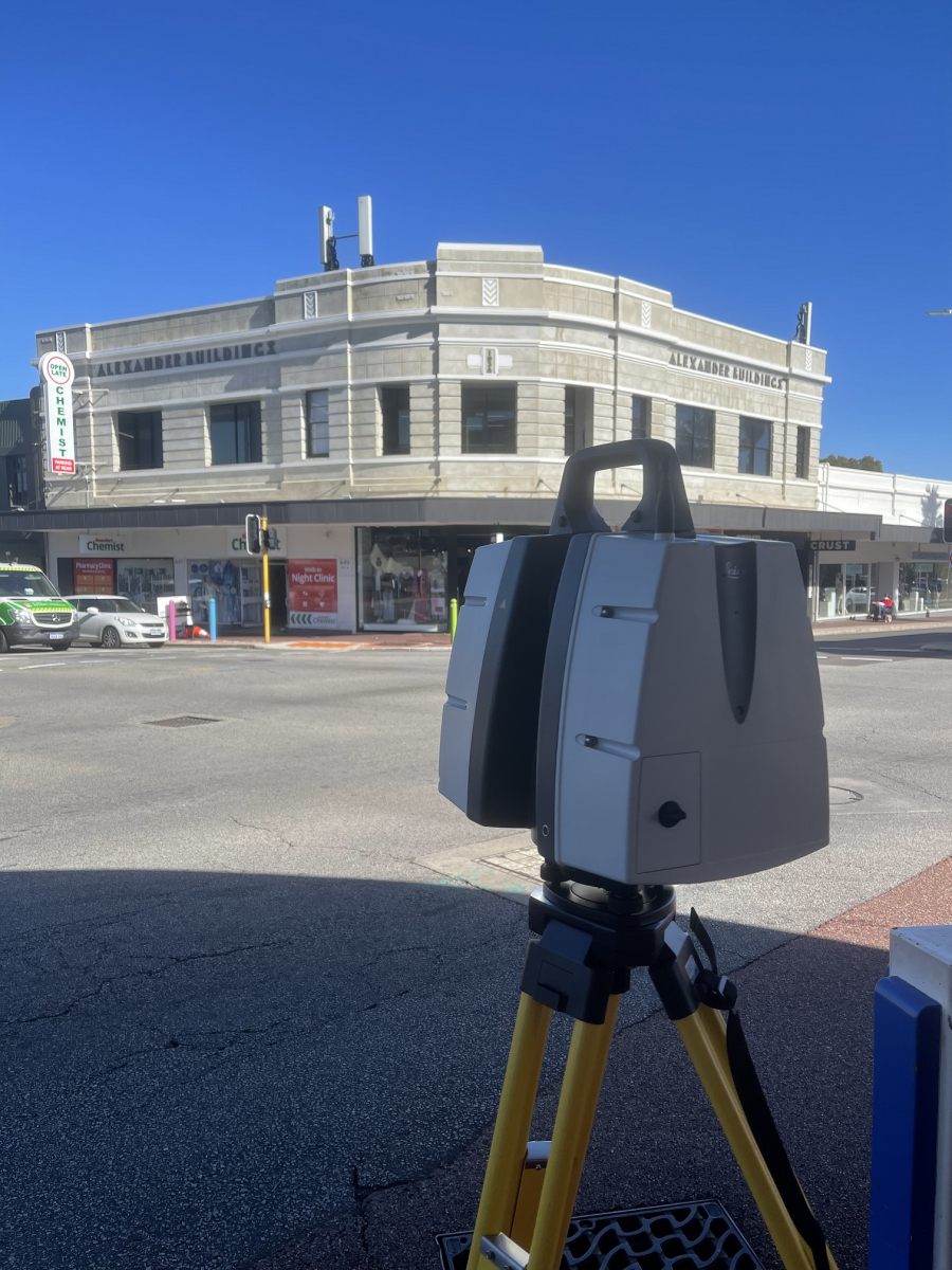
CYCLONE FIELD 360 in iPhone 12 Pro Max
Leica Geo System part of Hexagon has recently released CYCLONE FIELD 360 for iPhone and Android phones. We just ran a test to see how efficient it is using it on a small screen. The result is totally promising even on a 6 inch.
The only drawback is when you receive calls :). Therefore, yet having a dedicated tablet or an old retired phone (within the specs) is recommended.
Applying new technologies definitly increases efficiency
Project Overview
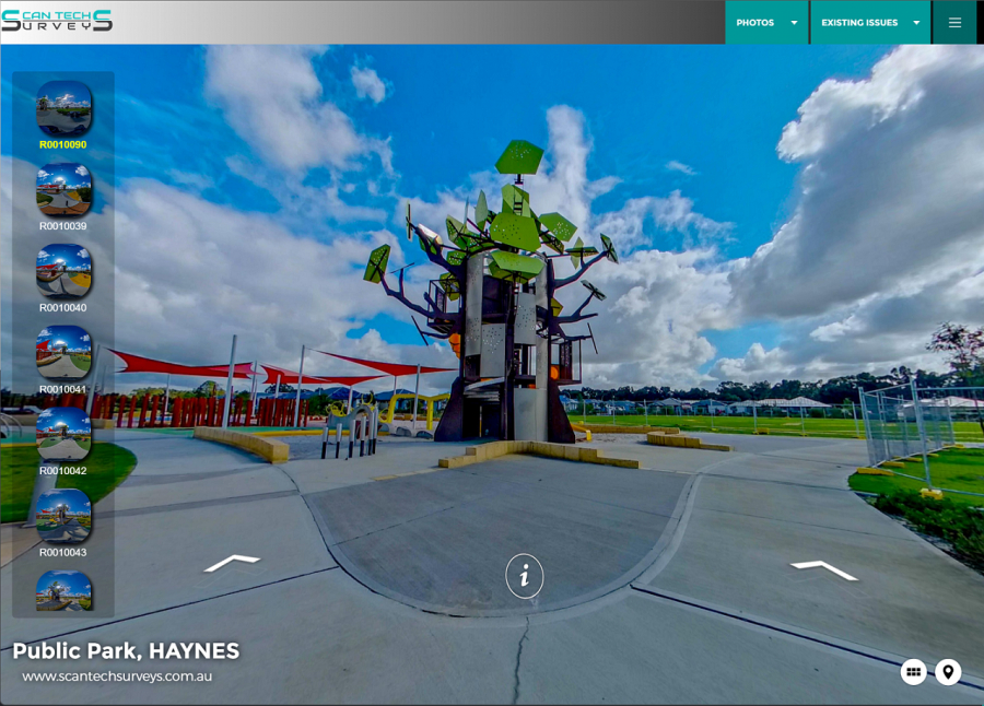
The goal of this project was a generating a dilapidation survey report using virtual tour. Unlike traditional dilap-reports, Scan Tech Surveys uses new technologies to conduct such reports.
We use latest 360 Degree Spherical imagery camera to capture photos and then compile virtual tour. The tour will contain all defective items in shape of, comments, close-up photos, spreadsheet, pdfs, videos, hyperlinks and any other medium that can help to document the current situation of a site.
- Location: Perth
- Category: Virtual Tour - Dilapidation Survey
Here is the link to view the tour:
https://scantechsurveys.com.au/Virtualtours/hayens/index.htm
Photogrammetry has been made easy these days, just took around 10 minutes to take 50 high resolution (24 Mega Pixels) photos and run a pre-calibration on lens distortion and finally there we go; a 3D model of a 50 cm x 50 cm statue.
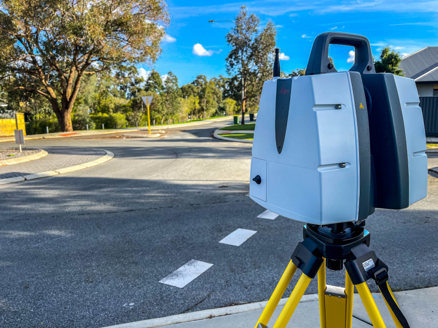
There is no more efficient way of doing feature surveys than using 3D Laser Scanning technology. Lots of benefits can be achieved; no revisit, 360 photos, point cloud, fly-through visualisation and lots of more..
This is our latest project going feature survey and as always we do we completed the job with 3D Scanning, simple is that! So, your client can ask for more information based on the captured scan data and eventually it saves them time and money. As a surveyor, you will ethically charge for office processing time ;).
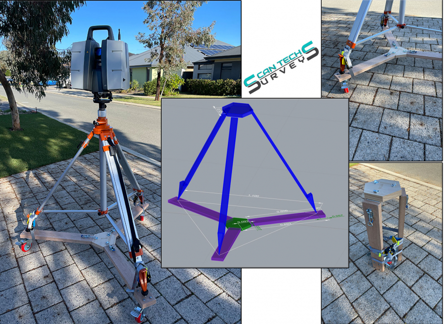
Simple things can make you feel good about what you are doing! Just wanted to buy a dolly for pushing scanner in internal spaces and faced to some unreasonable prices, so decided to get hands on tools. Rhino 3D was a perfect tool to wrap up a simple design and then headed to local tool shop to buy materials for fraction of the purchase price (about %5). Took 3 hours to put it together. Job done!
Technology is the key to be practical and efficient! Join us to welcome Leica Scan Station P50. The utmost accurate and high-speed terrestrial laser scanner (TLS).
Surveyors understand the values of survey grade compensator well and truly. With such an option, Leica Pxx series help a lot to increase efficiency in field capture stage.
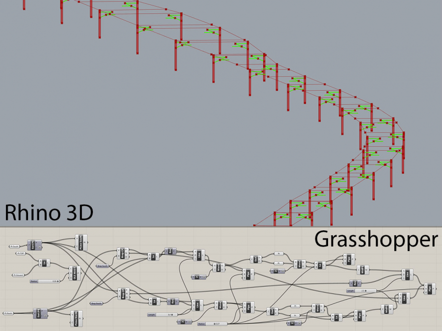
Automation increases efficiency for sure and this the approach we decide to take for modelling rail OLE models. The Top and Ground points have been extracted from point cloud using TopoDOT and MicroStation and the OLE objects have been created in Grasshopper (plugin for Rhino3D). 30 minutes spent for building the grasshopper script structure and 200 OLEs modelled instantly.
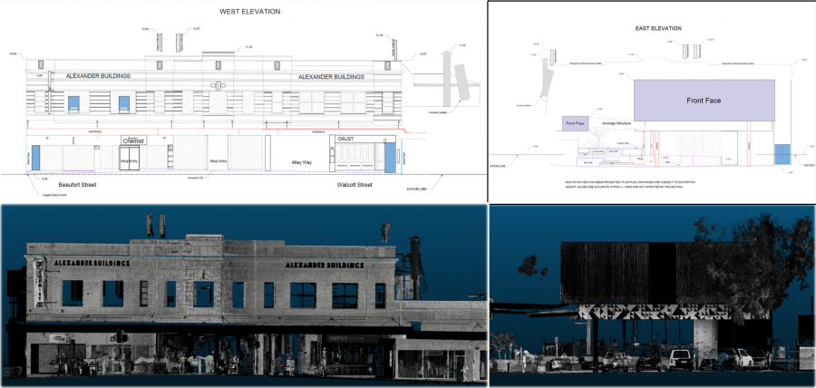
Project Overview
The main task of this project was updating the existing elevation views (East and West) for the purpose of locating Telstra antennas in both elevation views.
The elevation views were in arbitrary datum but related to each other
- Location: Mount Lawley - Perth
- Category: 3D Scanning - architectural