
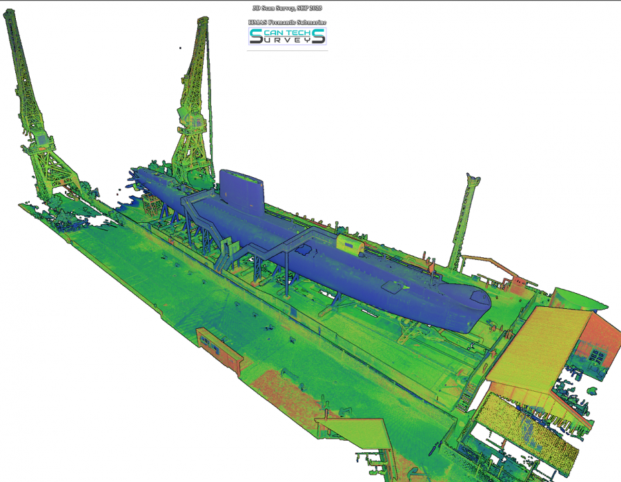
Scaffolding Planning
Our smart client recently reached out to get this historic submarine 3D scanned for the purpose of planning their scaffolding project. This can save them lots of execution time in the field and eventually save a lot of money for them. 3D Scanning technology can help various industries deal with spatial data and make their process much more efficient. This technology is the most efficient and cost-effective for accurate and reliable spatial data capture.
Utilising 3D Laser Scanning Technolgy for planning and descion making can help engineers and designers to be a better decsion maker.

Equipment Installation Planning
How often have you been involved in installation of an equipment on the existing structure? How would you make sure that everything goes right at the time of execution? If something goes wrong how much time and money will be waisted?
Well, 3D scanning technology can certainly help in this situation. The process is very clear, the existing structure that needs to be maintained would be scanned and 3D modelled. On the other hand, the new components need to be scanned and modelled too. Finally the two components will be assess in a CAD software to make sure that they are going to fit.
Here is a recent job the our team has completed.
Applying 3D Scanning in pre-installation stage can save you time and cost.
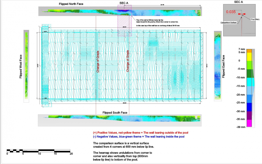
Project Overview
The main goal of the job was to determine the verticality and deflection report of this swimming pool. Other deliverables were the TIN model of the pool and gradient maps.
Short capture time, accuracy, efficiency and reliability are all charactristics of 3D scanning.
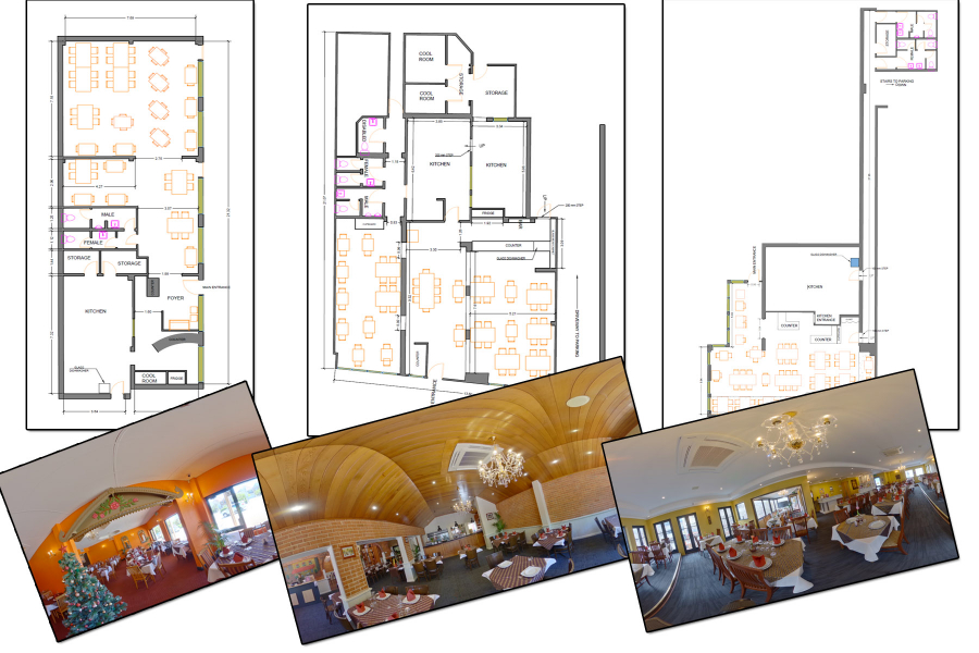
Recently, we have used 3D scanning to prepare floor plans for 3 restaurants (Thai Orchid) in order to be lodged an application to acquire liquor licence. All three places were captured just in 3 hours and data processing around 6 hours. Conventionally, each would take about a day.
There is no more efficient way than utilizing 3D Laser Scanning technology for creating Floor Plans.
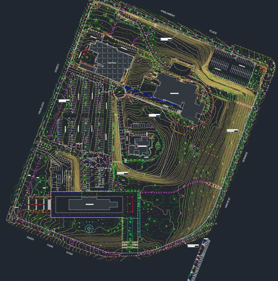
Project Overview
Detail Survey of Dumas house site using Leica P50 scanner. 470 scans were conducted in total and registered with an accuracy of +/- 10mm.
From 3D Scanning to Feature / Detail Survey
The Team has recently conducted such a fantastic job for 9 hectares of fully feature land. The feature surveys prepared in DWG and PDF format for plotting purposes. 5 different software packages where used to get to final result and by following effective procedure the quality is always guaranteed.
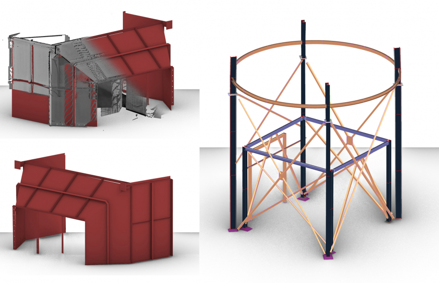
Equipment Installation Planning
How often have you been involved in installation of an equipment on the existing structure? How would you make sure that everything goes right at the time of execution? If something goes wrong how much time and money will be waisted?
Well, 3D scanning technology can certainly help in this situation. The process is very clear, the existing structure that needs to be maintained would be scanned and 3D modelled. On the other hand, the new components need to be scanned and modelled too. Finally the two components will be assess in a CAD software to make sure that they are going to fit.
Here is a recent job the our team has completed.
Applying 3D Scanning in pre-installation stage can save you time and cost.
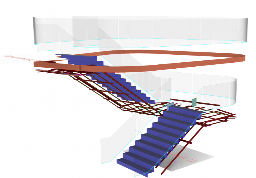
Project Overview
Accurate 3D As-built of internal staircases completed using P50. The challenge of the project was scanning the glazing around the structure of the stairs.
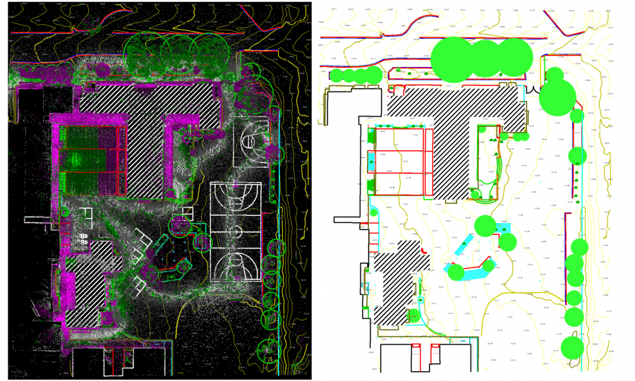
Project Overview
Using 3D Scanner for feature surveys is the most effective way of doing them. We have recently completed a primary school feature survey captured by a hand-held LiDAR scanner (Data credit to Mine Survey Plus).
- Category: Feature Surveys
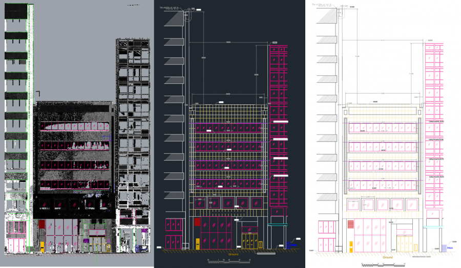
Project Overview
The main goal of this project was generating the 2D Elevation View of a 6-story façade. The challenge of the project was a big tree in front of the building so multiple setups had to be done to get the full details.
The elevation view was delivered in AHD (Australian Height Datum).
- Location: Perth City
- Category: 3D Scanning - Architectural