Façade Survey
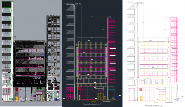
Project Overview
The main goal of this project was generating the 2D Elevation View of a 6-story façade. The challenge of the project was a big tree in front of the building so multiple setups had to be done to get the full details.
The elevation view was delivered in AHD (Australian Height Datum).
- Location: Perth City
- Category: 3D Scanning - Architectural
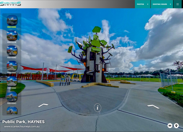
Project Overview
The goal of this project was a generating a dilapidation survey report using virtual tour. Unlike traditional dilap-reports, Scan Tech Surveys uses new technologies to conduct such reports.
We use latest 360 Degree Spherical imagery camera to capture photos and then compile virtual tour. The tour will contain all defective items in shape of, comments, close-up photos, spreadsheet, pdfs, videos, hyperlinks and any other medium that can help to document the current situation of a site.
- Location: Perth
- Category: Virtual Tour - Dilapidation Survey
Here is the link to view the tour:
https://scantechsurveys.com.au/Virtualtours/hayens/index.htm